Our Solutions
Three ways to work with us, depending on how much support you need.
Whether you need a complete image-based inspection solution including data collection, already have your own data and want us to transform it into actionable information, or simply want access to PRIMA to store and manage damage-augmented digital twins of your assets, we have the right solution for you.
Full Image-based Inspection
Comprehensive end-to-end image-based inspection solutions, covering everything from data acquisition planning and on-site data collection to advanced analysis and detailed reporting.
- Data acquisition planning and optimized drone paths
- On-site data collection by certified pilots
- Advanced image analysis for engineering insight
- PRIMA access for digital twin management


Advanced Image Analysis
Whether you already have inspection data or are planning to collect it, we provide expert consultancy and advanced analysis to extract maximum value from every data point.
- Consultancy on optimal imaging strategies
- State-of-the-art image analysis
- Technical report
- PRIMA access for digital twin management
PRIMA Platform
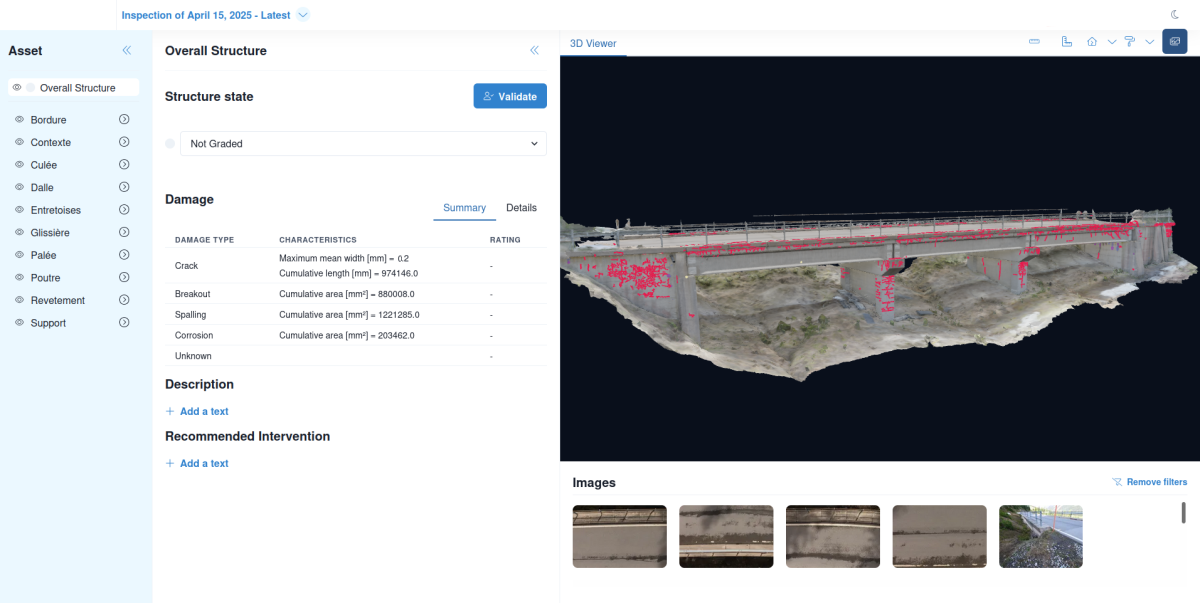
Das ist PRIMA!
PRIMA is a web application for digital inspection of structures, providing access to damage-augmented digital twins with full traceability to original inspection imagery.
- Geo-referenced 3D models with multiple textures
- Quantified 3D damage mapping
- Original camera-view image projection
- Damage and component grading

They trust us
From federal and cantonal offices to railway companies and power plants, leading organizations trust our innovation.


Not sure which package is right for you?
Our team is here to help. Contact us for personalized guidance and find the solution that best fits your needs.